Pilot Briefing

Pilot Briefing
Pilots
Contact Information
Driggs-Reed Airport
253 Warbird Lane
Driggs, Idaho 83422
Teton Aviation (FBO)
Phone: (208) 354-3100
Airport Superintendent
Billy Cyr
Phone: (208) 354-2362
Email: bcyr@driggsidaho.org
Hours: Monday-Thursday 8:00 a.m. - 5:00 p.m.
Closed Fridays and Federal Holidays
General Aviation Info
Flight & Weather Data
Info
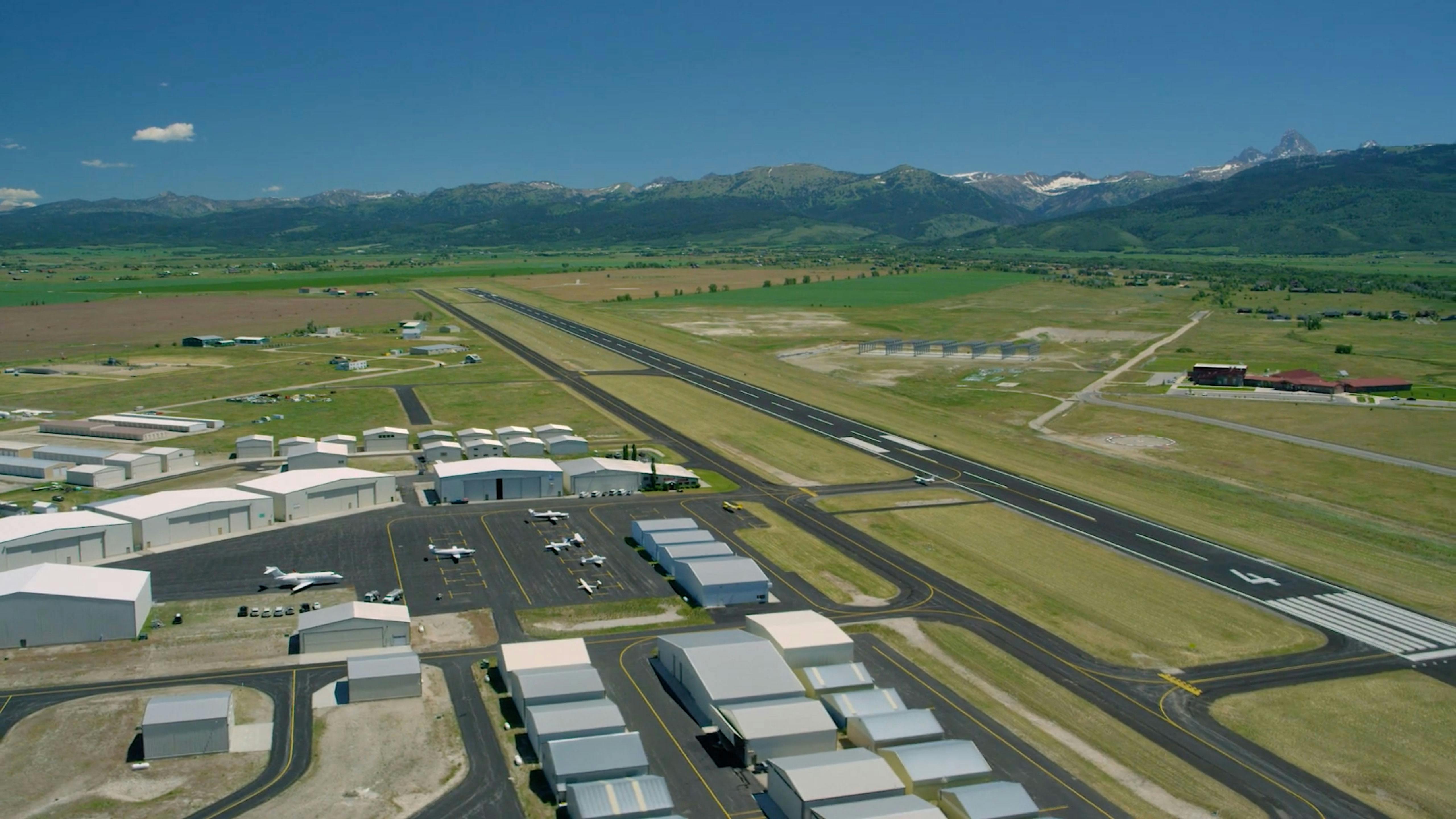
Welcome to Driggs Airport (KDIJ) at an elevation of 6,231 ft. We are located in Idaho’s beautiful Teton Valley, so pilots flying to our area should be prepared for the potential for turbulence, downdrafts, wind shear, and winter storm conditions. During the summer months the air thins considerably, density altitudes can exceed 10,000 feet.
Time Zone: UTC -7 (UTC -6 During Daylight Saving Time)
Runway
Our runway and taxiway are 7,301 feet in length, with a runway width of 100 feet, and a weight capacity of 75,000 pounds double wheel landing gear.
Runway: 4/22 (7,301’ x 100’) Asphalt, Gradient: 1.5
Note that runway 22 is RIGHT traffic.
Frequencies:
CTAF 122.7
AWOS 120.775 or call (208) 354-6661
Clearance delivery Salt Lake Center 128.35 or call (801) 320-2568
Procedures
Variation: 12E (2015)
Beacon: White-Green (Lighted Land Airport) Operates Sunset to Sunrise
ARTCC: Salt Lake City Center
FSS: BOISE FLIGHT SERVICE STATION
Sectional Chart: Salt Lake City
Wind Indicator: Lighted
Segmented Circle: Yes
Lights: ACTVT MIRL RUNWAY 04/22 & REIL RUNWAY 04/22 - CTAF
PAPI: RUNWAYS 04 & 22 OPERATE CONTINUOUSLY
Runway heading: 037 Magnetic
Runway Heading: 217 magnetic
Visual Slope Indicator: 4-light PAPI on left RWY 22, right RWY 04 (3.50 degrees glide path)
Nearby Airports:
KJAC – Jackson Hole Airport (18 nm SE) View JAC Airport Info at AirNav.com
KIDA – Idaho Falls Regional Airport (44 nm W) View IDA Airport Info at AirNav.com
IFR Departure procedures: LAMON FOUR (RNAV)(Obstacle)
IFR Approaches: RNAV (GPS) RWY 4, RNAV (GPS) - A
VFR Noise Abatement ARRIVALS
- Southwest over Pine Creek Pass, remain west of Highway 33, overflying the Teton River to avoid flying over residential zones from Victor to Driggs. Remain at or above 2000 feet AGL as long as practical before descending to pattern altitude.
- Southeast over Teton Pass, follow Highway 33. Remain south of the town of Victor, fly northbound, west of Highway 33, over the Teton River to avoid flying over residential zones from Victor to Driggs. Remain at or above 2000 feet AGL as long as practical before descending to pattern altitude.
- Northwest, West of Tetonia, proceed directly to the airport at 45°. Remain at or above 2000 feet AGL as long as practical before descending to pattern altitude.
- North over Felt, remain west of Highway 32 and the town of Tetonia, then proceed directly to the airport at 45°. Remain at or above 2000 feet AGL as long as practical before descending to pattern altitude.
VFR Noise Abatement DEPARTURES
- Avoid unnecessary and lengthy ground run-ups, particularly for runway 4 departures.
- Avoid departing over the city of Driggs. Avoid flying over neighborhoods and subdivisions to the east of Driggs.
- Runway 22: Turn right to a heading of 240° as soon as practical to avoid homes in Huntsman Springs subdivision. Continue climbing until above 2000 feet AGL, if possible.
- Runway 4: Turn left to a heading of 360°. Avoid flying over subdivisions east of Driggs.